
 Jubilee Park Photo: Tim Heaton
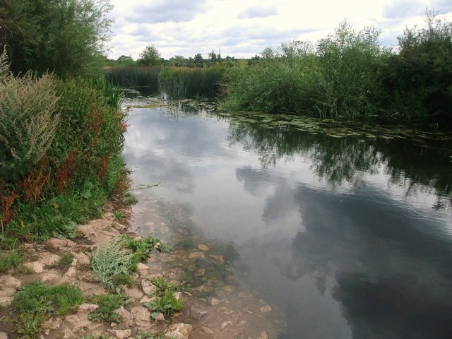
Jubilee Park has a small car park with a height restriction barrier at the entrance. It is possible to unload vehicles and trailers prior to the barrier although space is tight. The get-in is a short carry across the park to a small beach at the confluence of the Soar and Sence.
At this point their confluence increases the volume of water available and the likelihood that the river will be navigable from here. It is possible, at very high water levels, to start paddling on the Soar further south closer to its source. Either at Narborough railway station or more exceptionally, The Mill on the Soar at Broughton Astley (LE9 6QA). Care should be exercised through to Jubilee Park from both points for low bridges.
The river is narrow and winds its way northwards towards the canal, drawing closest at Blue Bank Lock a portage up onto the canal is possible at this point but the river affords the more interesting passage on through Ayelstone Meadows nature reserve. A new footbridge built to link the development of Fosse Meadows with the Great Central Way has been a bonus for walkers and cyclists particularly as the new Everard Brewry site includes an excellent cafe (Jenno's) and a branch of Rutland Cycles.
 Packhorse Bridge
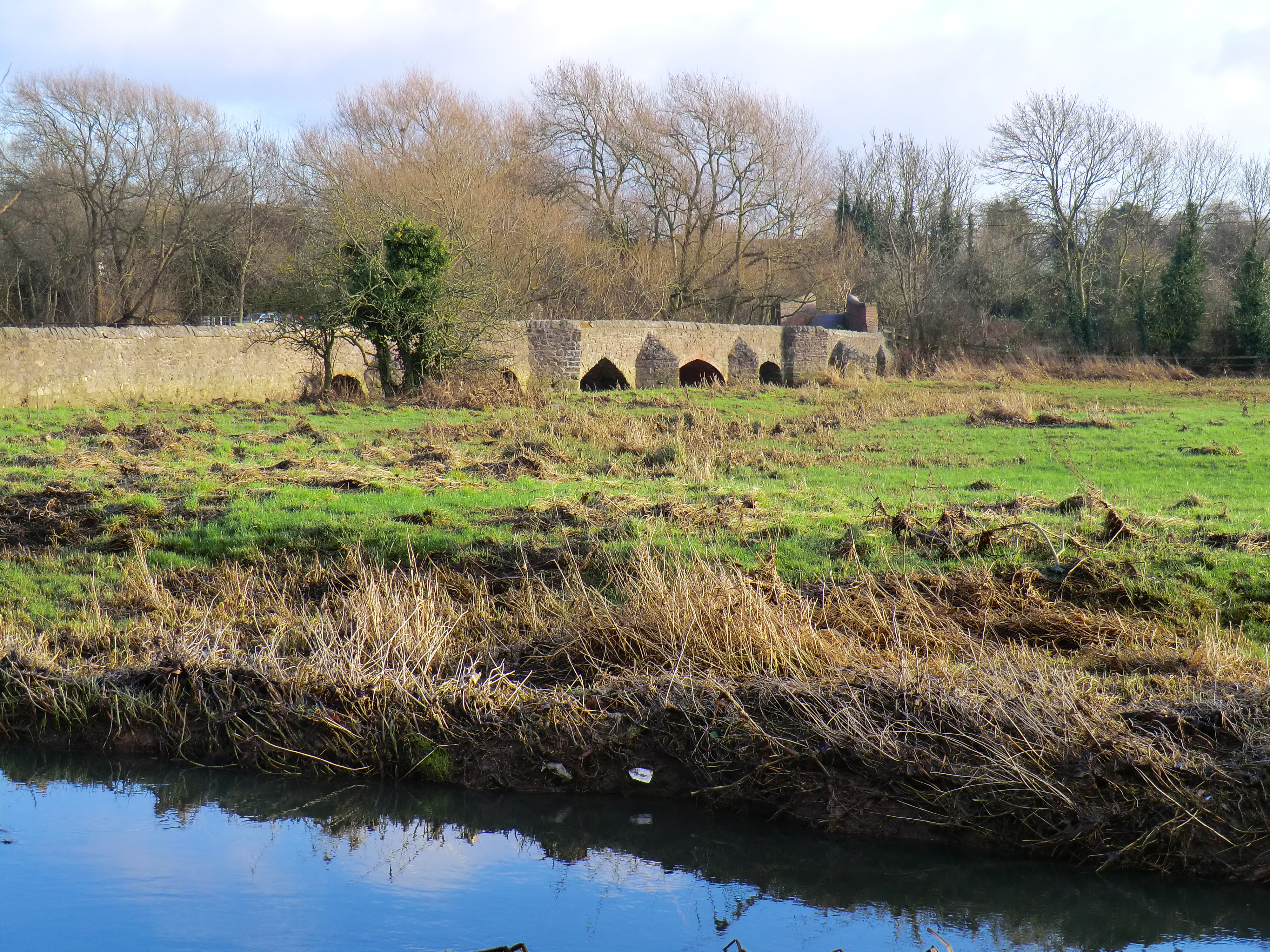
At Packhorse Bridge there is a further choice of turning right with the River Soar along the face of one of Leicester’s oldest bridge crossings onto the canal or again following the course of the river which becomes the River Biam via Lubbesthorpe brook to the left over a small diagonal weir.
Just under a mile from the small weir a footpath crosses the river via a very low bridge which, in high water, will need to be portaged. Care should be exercised on the approach as the river narrows and the flow increases.
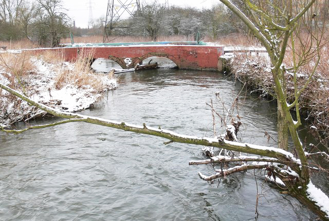 Low bridge on River Biam Photo: Mat Fascione
If you have transferred to the canal, prior to Aylestone Mill Lock there is a small weir to the right leading onto a small loop running out to Aylestone Road and back to the canal. This mill race can be very shallow and has a low bridge in high water it is often blocked with obstacles. This area had been the site of a canoe club in the 60’s, many paddlers can still recall the slalom gates on the river.
The expanding gas holders could have been seen whichever approach you made to Freeman’s Lock but these were dismantalled in 2019 and the area is due to be redeveloped for housing.
The river continues through the meadow meeting up with the canal at a small weir dropping into the river from the right just before it passes through the centre of the Faircharm Industrial Estate built on the site of a medieval Mill. This was home to the John Bull Rubber Company, later Dunlop who left the site in 1971 with the loss of 800 jobs. Parking in this area close to the cycle way offers another start point for a circular paddle.
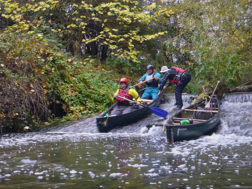 St. Mary's Mill Weir
The canal skirts the outside of the buildings decending down through St Mary’s Mill Lock. A right hand channel before the lock leaves under a wroght iron foot bridge and on to a small smooth sloaped weir which is shootable provided the channel is not clogged with vegitation or branches.
Below the lock is where the River Biam rejoins just prior to the railway bridge carrying the Ivanhoe Mineral Line Railway. After which is a large pool at the head of Power Station weir and Freeman’s Lock.
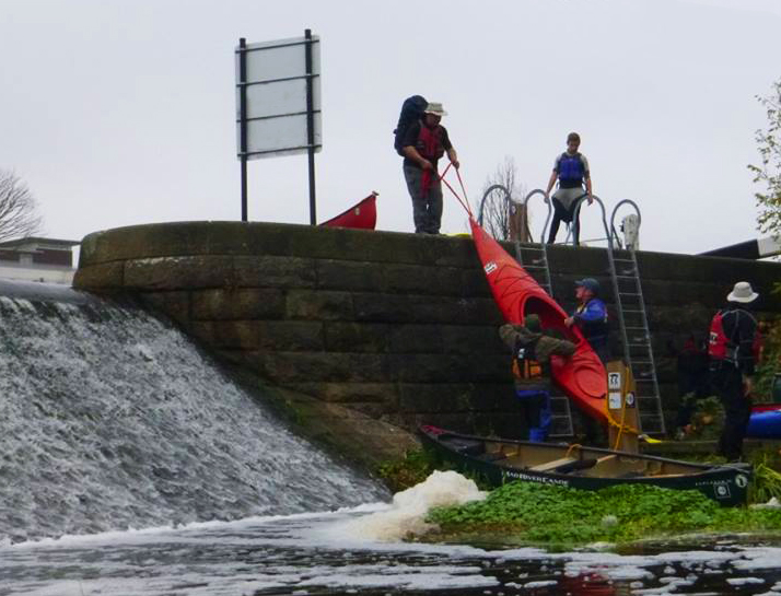 Portage at Power Station Weir
The weir is the highest on the Soar and named after a power station long since demolished and replaced with the new home of Leicester City Football Club.
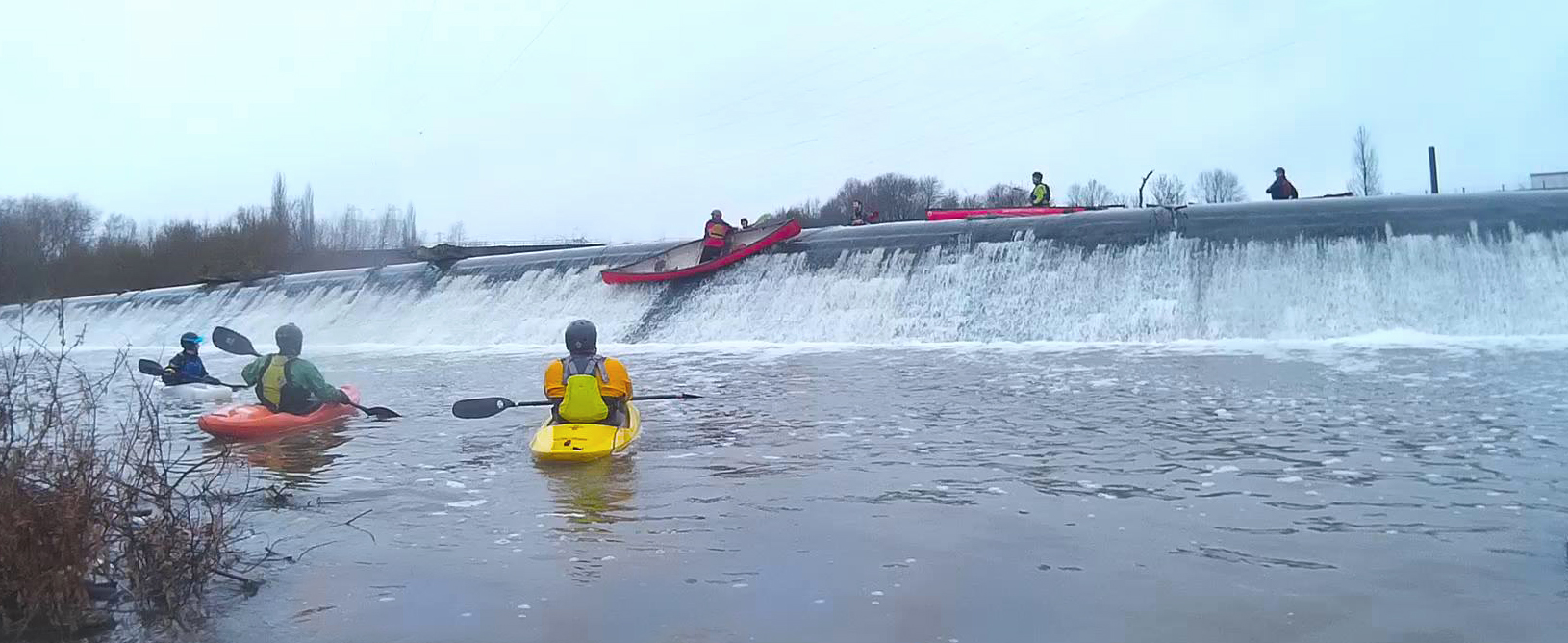
The stadium dominates the view from the top of the long 12 foot high barrier (pictured at the top of the page). The weir is shootable although the top lip often requires a committed approach to clear and a quick switch to descend the weir face side-on in all types of boat to land cleanly in the shallow waters below the smooth face.
As with all weirs, inspection and experience should inform an individuals decision to shoot or portage. The area around the weir has been identified as a potential site for re engineering to produce a play wave and to then add a visitor centre.
The portage is to the right of Freeman’s Lock using a newly installed lock ladder down to the island to re-launch at the foot of the weir. This avoides a section of the tow path which can get very busy with pedestrians and cyclists and a very high re-entry after the lock.
All routes on the navigation converge for the next 400 metres then the original river course exits left
under a cast iron footbridge next to Leicester Rowing Club’s impressive modern
boathouse. Continuing on the man-made ‘mile straight’ passes the new De
Montfort University buildings on what was the site of Leicester Polytechnic.
The opposite bank has been redeveloped with students in mind from the sidings
of the Great Central Railway. The Tesco Metro is housed in the old electricity
generator and hydraulic power house. I remember the area as the giant Vic Berry
scrap yard for railway carriages.
Great Central Railway through Leicester by Nigel Tout
The Mile Straight ends at the A47 King Richard’s Road Bridge by Castle Gardens and St Nicholas Circle. This area of Leicester has had many historical connections some previously buried under a large, busy road island and underpass. King Richard’s remains most recently under one of the car parks but back in the 1930s the footings of the Roman baths where excavated as work commenced for a new public swimming pool. Jewry Wall was the entrance to the baths and survived as part of a Saxon Church (St Nicholas). At 9m high it is one of the largest surviving examples of Roman masonry in Britain.
Past the road bridge, the original river returns under a long low bridge on the left. This backwater can be paddled making allowance for the low clearance of some of the bridges. The distance is the same. Ahead is Evans weir, known locally as Kirby and West Weir after the depot for Leicester’s main door-step milk delivery company. The site has recently been redeveloped as a Secondary School Academy, another victim of changing social habits.
K&W vendingmachines
On the opposite bank is Friars Mill, Leicester’s oldest wool mill, dating back to the 18th century and the home of Donisthorpe & Co. Ltd. After a major fire in 2012 what was left of the site was in danger of being lost. The City Council took on the renovation and redevelopment of the site. The award-winning work resulted in office and workshop space and new moorings for visiting boaters.
Evans weir can be shot through the middle section just before the sluices. Approaching at a diagonal to the flow and sliding down the weir side on, with a brace ready for the bottom. The portage is to the left of the weir and 400m down to Rally Park to relaunch at the steps. It is hoped, that with the agreement of the Canal & River Trust and Environment Agency, a portage down the left-hand side of the weir could be facilitated, making use of the now dysfunctional sluices that just collect unsightly debris and jetsam.
From here the river continues past Frog Island Bridge, with its ornate ironwork, through what was the industrial heart of the city with large hosiery mills and factories on both banks. The building on the left just past the bridge was the rebuilt Cricketers Rest pub (no longer trading) and has a magnificent fig tree growing out of the river-bank. This whole area is earmarked for extensive redevelopment which will leave little evidence of the toil that went before. Some of the arches of the Great Western Railway viaduct still stand, built to last out of Staffordshire blue bricks and currently defying the developers.
The bridges of St. Margaret’s Way mark the boundary of Abbey Park. A more ornate concrete footbridge (into the park) follows. A rustic stone bridge designed by William Barron follows just prior to Abbey Park Weir. The main route in all but high flows is directly after the bridge, to the right of the first island. In high waters a second weir approached to the left of the island has less of a tow back at the base. The pool below the weirs is now very silted and a haven for waterfowl but it had been used as the municipal boating lake and a venue for the November firework display. The exit from the park is under a further ornate iron bridge the deck of which still has the tram tracks buried under the tarmac. The corporation tram station was to the right on the island formed between the river and canal. A new footbridge to serve the redevelopment of the Wolsey knitwear site is 50m further on. The retention of the boiler chimney brandishing the company name and the distinctive water tower were part of the requirement for the housing redevelopment. The National Space Centre with the 42m high rocket tower, clad with inflated ETFE cushions, dominates the left bank below the bridge. The river turns right across the top of a Swan’s Nest weir which at normal levels is a small drop, at high levels it washes out completely. The Canal re-joins to the right of the weir at the entrance to Belgrave Lock. Portaging is on the left of the lock on the non-towpath side down on to a platform below the weir. To the left, after the weir pool is a small engineered channel entering the river. This was the outflow for the boilers of Abbey Pumping Station built in 1891 with four beautifully ornate and gilded Gimson Woolf compound beam engines, used to pump the sewage of Leicester (20 million gallons a day) to a sewage farm at Beaumont Lees. The Beam engines were replaced in 1939 by a ram pump which continued until 1964. The site is now Leicester's Museum of Science and Technology and well worth a visit on bank holidays when they have their steam days.
Another 150m down the river is the Ross Walk footbridge, which is a single
point suspension bridge, locally known as the ‘A’ bridge. On the right bank is
TS Tiger, one of the two Sea Cadet units on the Soar. The river continues past
Belgrave Park on the right a mooring platform and steps up the bank signal an
invitation to visit this microcosm of Georgian gentry with a formal park,
house, stables, church and Belgrave Hall which is now a heritage
site offering a glimpse into a wealthy merchant’s home and gardens.
We'd love to hear from you, you attractive person you.