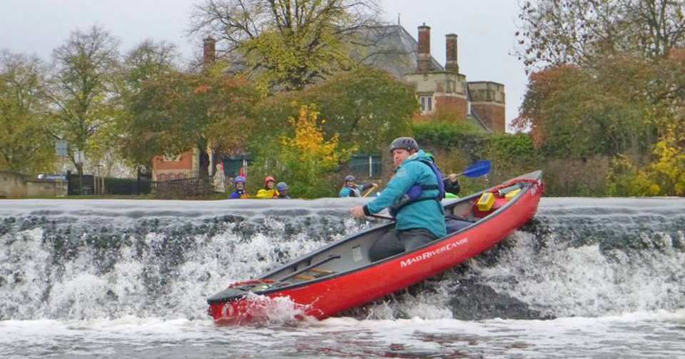
 Abbey Park Weir - Mark Dawson
Abbey Park Weir - Mark Dawson
Abbey Park Weir - Mark Dawson
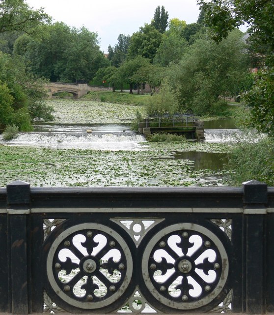 Abbey Park From Abbey Park Road Bridge - Mat Fascione
Distance: 2 miles (3.2km)
Can be extended by 1.3 miles
Portages: 2 (3)
Weirs: 1 (2)
Gauge readings: Freeman's 2158 (.15m>)
Time to complete: 1hrs (2hrs)
Difficulty: Easy
Start: Abbey Park, St Margaret's Pastures
Map reference: Start SK585054
Post Code: Start LE1 4DB
Alternative start point
Abbey Meadows
Map reference: SK588064
Post Code: LE4 5FH  Link to route in PaddlePoints
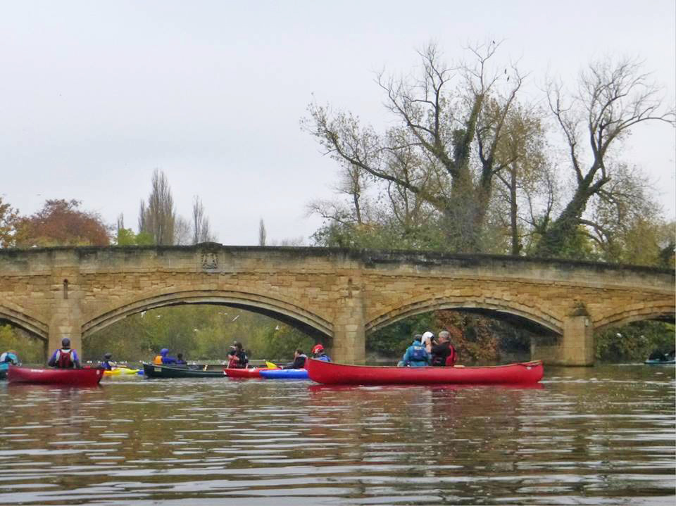 Group of paddlers at Abbey Park Bridge - Mark Dawson
Peppercorns Cafe in the old cricket pavillion by the bridge is worth a visit for a warm up and drink or ice cream depending on the time of year.
St Margaret's Pastures is a pay and display card park. Portaging boats on the pathway between the all-weather pitches and the park boundary fence will bring you to the river at the south side of Abbey Park. From here it is a short paddle to the stone bridge in the heart of the park and just through it are the weirs and islands. In all but high flow the weir directly after the bridge is good to shoot. In high waters the weir to the left between the islands has less of a tow back. The pool below the weirs is now very silted and a haven for water fowl but used to be the municipal boating lake and venue for the November firework display.
History of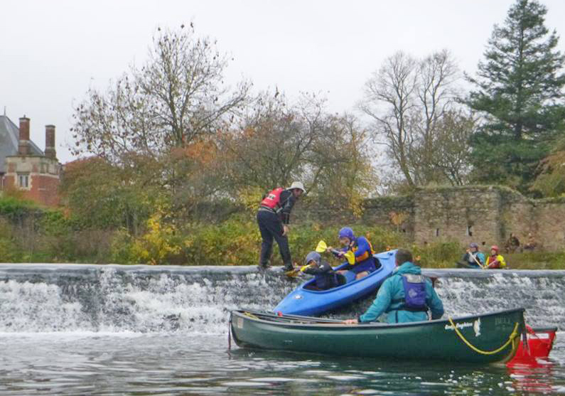 Assistnce at Abbey Park Weir - Mark Dawson
Abbey Park road bridge still has the tram tracks buried under the tarmac. The corporation tram station was to the right on the island formed between the river and canal.
The Island is known as Wolsey Island after the famous knitwear manufacturer who had factories hear and in other parts of Leicester. Although now redeveloped for housing, the original chimney and water tower have been preserved as a reminder of this heritage.
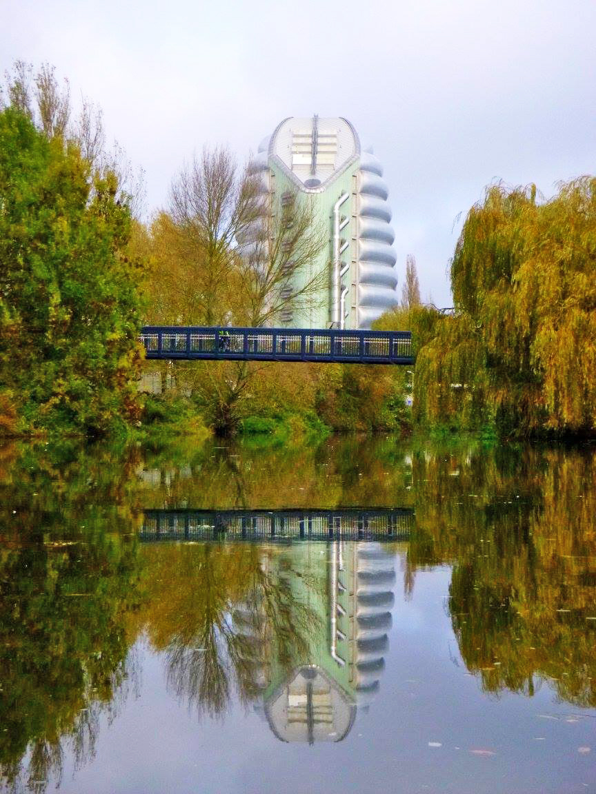 Space Centre & foot bridge - Mark Dawson
The river continues under the new footbridge and past the Space Centre on the left to another smaller weir (Swan's Nest). The loop continues across the top of the weir towards Belgrave Lock. A right turn into the canal starts the return journey back between what used to be British United Shoe Machinery factory and the Tram sheds. The canal runs parallel to the right of Leicester's 'Golden Mile' - Asian food, jewellery and clothing shops.
More information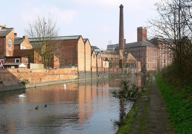 Canal past BUSM site - Mat Fascione
Back under Abbey Park Road and to Lime Kiln lock for a portage. The following pound is where the 1967 IWA Boat Rally took place and a plaque obscured by undergrowth celebrates the work done to restore the lock for the event.
Restoration of Memory Wharf which is a short arm to the left is underway. The painting shows it when it was busy.
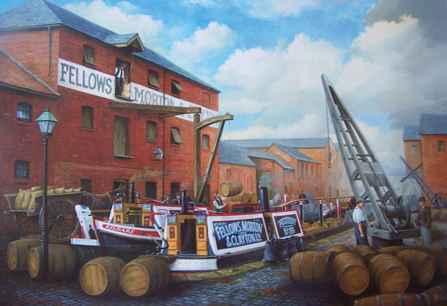 Painting of Memory Wharf Whalf in its hay day
Continue on between the park spoil bank on the right and assorted industrial buildings on the left until you go under a new footbridge connecting the town with the park. The new building on the left is Morningside Arena, home of Leicester Riders Basketball team. You are back at the car park as you go under the older, second footbridge.
We'd love to hear from you if you have done this paddle,
spotted a correction or just want to say hello!