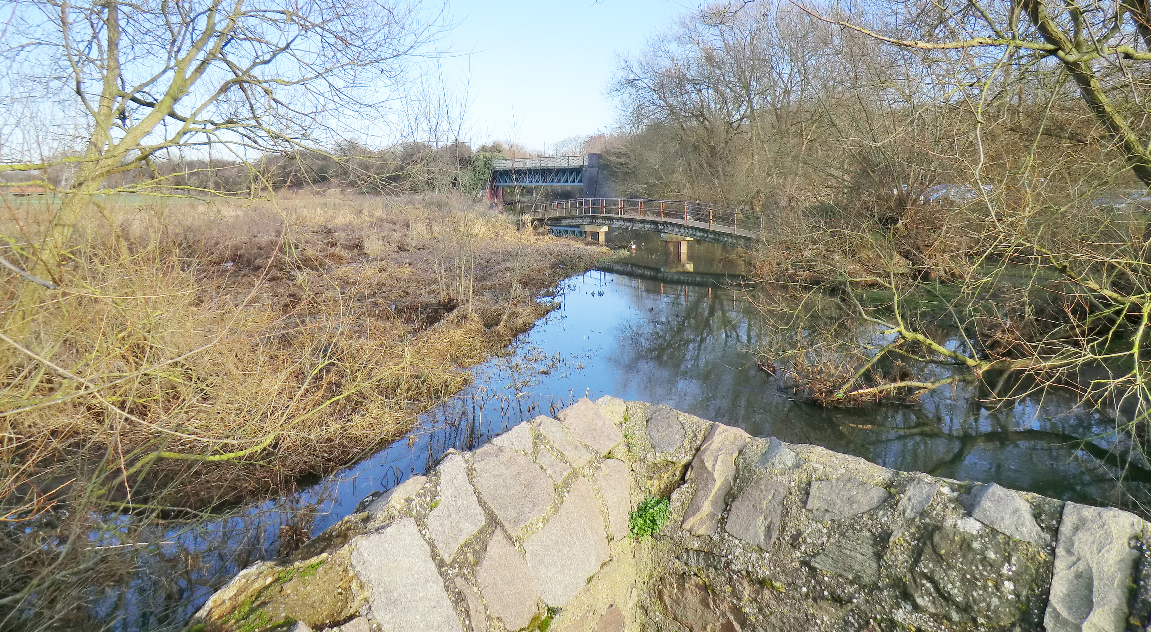
 Photo: Footbridge, Aylestone Meadows - Mat Fascione
Distance: 8.8 miles (14.2km)
Time to complete: 4hrs
Difficulty: Moderate (backwarters can be over grown)
Portages: 7
Weirs: 1
Gauge readings: 2188 (1m>)
Start: Jubilee Park, Narborough
Map reference: SP551987
Post Code: Start LE9 2BH
Alternative start points:
Faircharm Ind. Est., Evelyne Drive
Map reference: SK575025
Post Code: LE3 2BV
Aylestone Lock
Map reference: SK578017
Post Code: LE2 8TB
Packhorse Bridge, Marsden Lane
Map reference: SK569009
Post Code: LE2 8LT
New Bridge Road, Glen Parva
Map reference: GR SP563985
Post Code: LE2 9TG
 Link to route in PaddlePoints
 Portage, Glen Parva - Andy Oughton
The extended loop around Fosse Meadows starts by using the route described from Jubilee Park on the Glen Parva page. This loop has other start points mentioned in the text. On arriving at the Soar Valley Way Bridge continue paddling northwards on the river towards Leicester along a very rural stretch of water that hides its proximity to the bustle of Fosse Park; why do we call hectares of retail shops ‘parks’?
More information on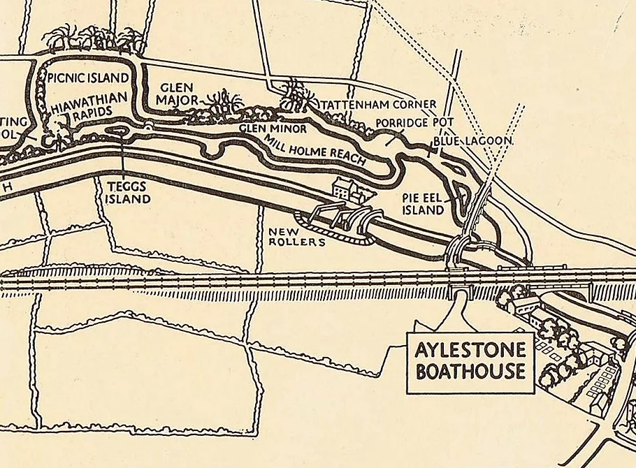 Map from Aylestone Riverside Resort web site by Chris Ayriss. Well worth a
visit. Note: boat rollers at Kings Lock
Map from Aylestone Riverside Resort web site by Chris Ayriss. Well worth a
visit. Note: boat rollers at Kings Lock
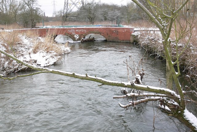
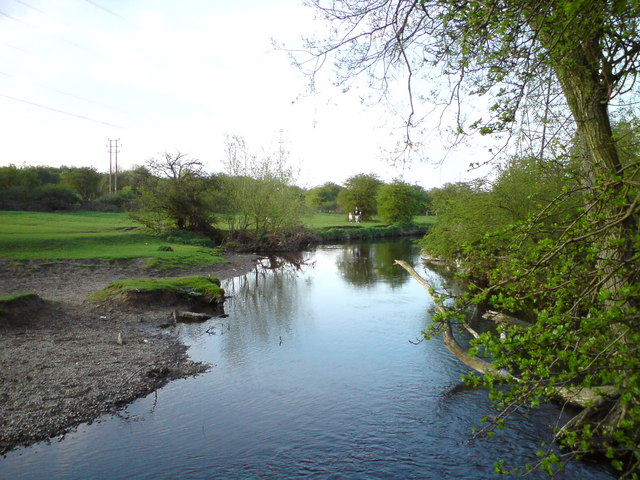 Photo: River Biam - Colin Hoskins
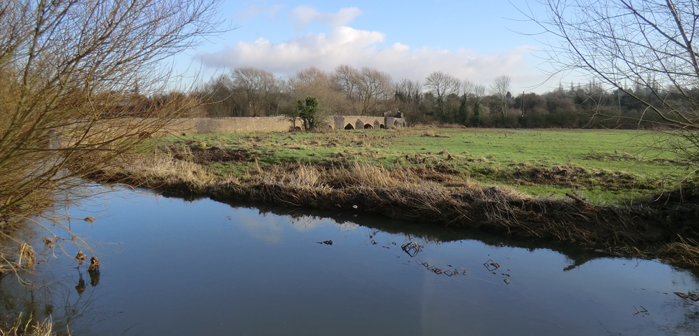
Just over half a mile from the road bridge the River Biam forks off to the left just before the Soar turns right and runs along the face of Leicester’s oldest causeway bridge. The last arch of the 15th century Packhorse Bridge is the best to head for and takes you out under a further footbridge to the river as it changes from cut canal navigation to enlarged natural river. For this loop, take the folk onto the Biam via Lubbesthorpe Brook to the left and then, after a few strokes, shoot a small diagonal weir by the causeway bridge. Braunstone Lane Bridge is a further 275m before the river begins to follow the embankment of the Great Central Cycleway: part of Sustrans Route 6 from Dover to Inverness. The river dips under the old railway line and continues across Aylestone Meadows nature reserve. Just under a mile from the small weir, a footpath crosses the river via a very low bridge which may need to be portaged. Care should be exercised on the approach as the river narrows and the flow increases. This area has a raised boardwalk for the many walking visitors. More information about the Meadow can be found here.
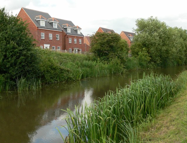
Below the low bridge is Pebble Beach a well-known local spot for cooling off in the summer (as the photo shows). The channel is still narrow and can be a bit of a scrap as it approaches Faircharm Industrial Estate on the site of a medieval Mill. This was home to the John Bull Rubber Company, later Dunlop who left the site in 1971 with the loss of 800 jobs. Parking in this area close to the cycleway offers another start point for a circular paddle. The Biam goes through the middle of the estate, the flow being increased with the addition of water from a side weir on the navigation. The river bears right and then under a footbridge as it rejoins the river and navigation below St Mary’s Mill Lock this is the point to start heading back. Portage the lock (best done on the non-towpath side and relaunch in the weir arm by the disused footbridge). This section is very defiantly a man made canal however it bends around factories and gas holders, which are in the process of being dismantled. Just under a mile from the lock is another bridge and Aylestone Mill Lock. This is yet another point to start this loop although parking on the road is recommended as the car park has a poor security record. From the top of the lock continue past a new supermarket, bridge and housing until you arrive at the Braunstone Lane Bridge and Cycleway bridge beyond which is the footbridge on the right that brings the narrow river in at Packhorse Causeway.
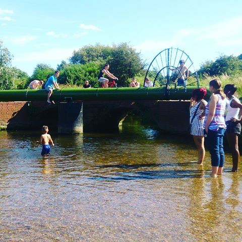 Pebble Beach, Aylestone Meadows
FaceBookParking and another option for a start point is opposite the footbridge accessed from Marsden Lane. To continue the extended loop, paddle under Packhorse Canal Bridge (No.105) and on to Kings Lock and another portage. If you are lucky the Tea Room with its open fire in the winter and garden in the summer will be open and willing to serve you refreshments. Check their page.
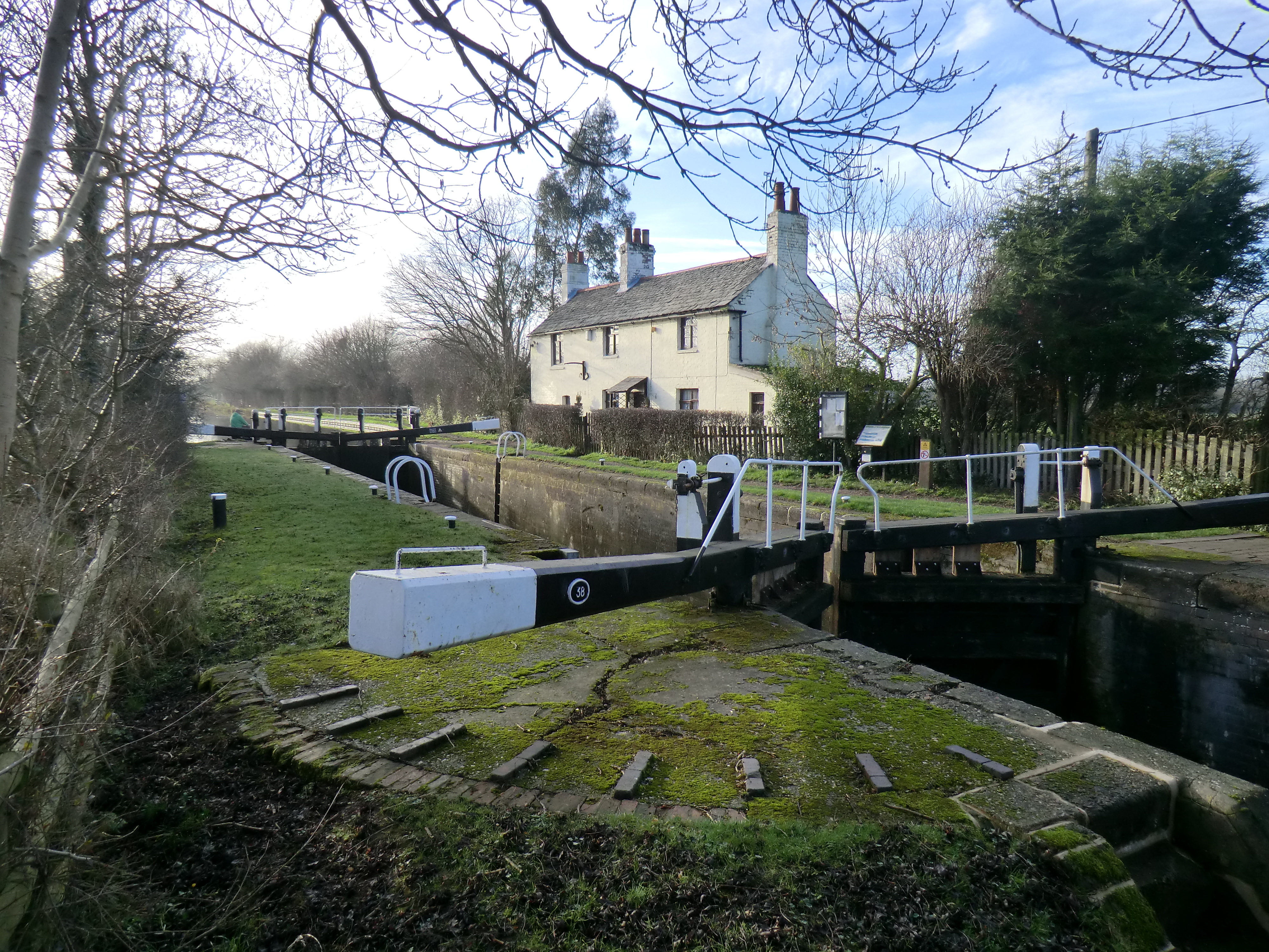 Kings Lock & Tea Room - Andy Oughton
This area was the site of the 'Aylestone Riverside Resort' in the early 1900’s. Photographs exist of punts and canoes being hired from here. Quoted thus “the backwaters and open pools are amongst the most beautiful water spots in the country, comparing in scenery and in volume of water to the fashionable reaches of Cherwell and the upper reaches or the Cam. You start in the heat of a summer's day, but soon you are gliding along underneath a canopy of trees, negotiating bend after bend of delightfully cool waterway." From Kings Lock the watercourse is the start of the Grand Union Canal heading to London via Foxton Locks. The trip continues back towards Glen Parva along a surprisingly rural and pretty length of canal with two more lock portages; one of which is a little tight around the bridge and care should be taken for the many cyclists that share this route. The remains of another Great Central Railway bridge are encountered not long before the portage from the canal to the River Sence. The get out is just before Whetstone Lane lock and Bridge 99 on the right hand, towpath side. There is a small parking area at the end of New Bridge Road which can be an alternative start point for this loop. A tree saw is almost as important as a paddle if you want to make unhindered progress on the next stage of the route. Access to the River Sence is down the bank by the footbridge at the back of the parking area. The Sence heads westward back under the railway bridges, past the back of Whetstone Tip and a small sewage works. It is more rural than that description might suggest. A portage around a low field bridge may be needed just prior to arriving back at the confluence with the Soar at Jubilee Park.
We'd love to hear from you if you have done this paddle,
spotted a correction or just want to say hello!